What’s planned for Whenuapai
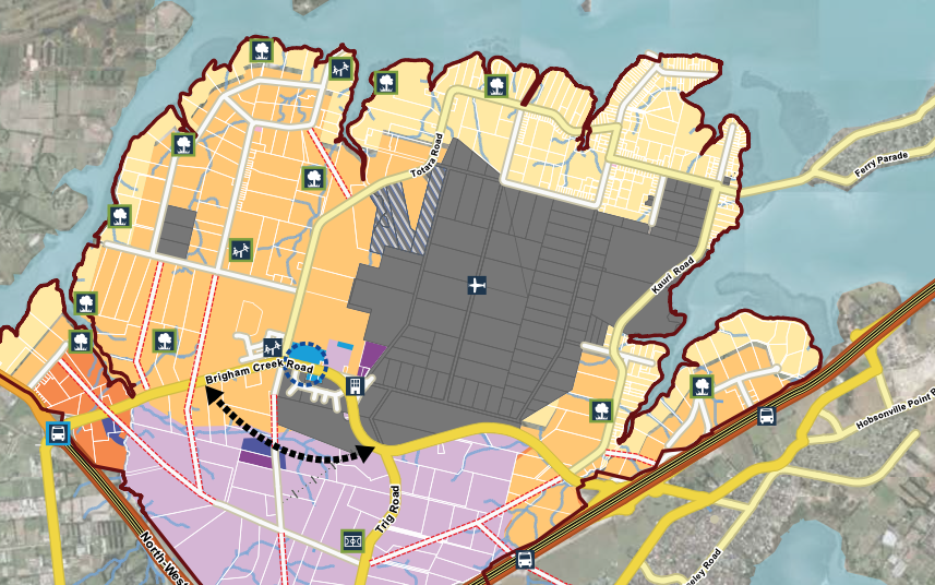
Whenuapai Structure Plan Map
Sep 2016
The Whenuapai Structure Plan shows us how the Auckland Council plans to transform Whenuapai from a semi-rural environment to an urban community over the next 10 - 20 years, guiding and defining land use, and infrastructure. Read more at: https://www.aucklandcouncil.govt.nz/
Key considerations in the Whenuapai Structure Plan
Development of the Structure Plan has considered the constraints and opportunities in the area. The following key elements
have been explored to ensure sustainable development in the structure plan area.
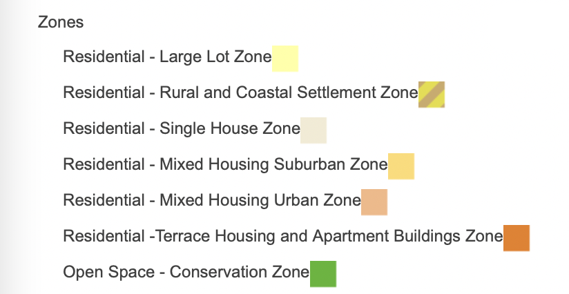
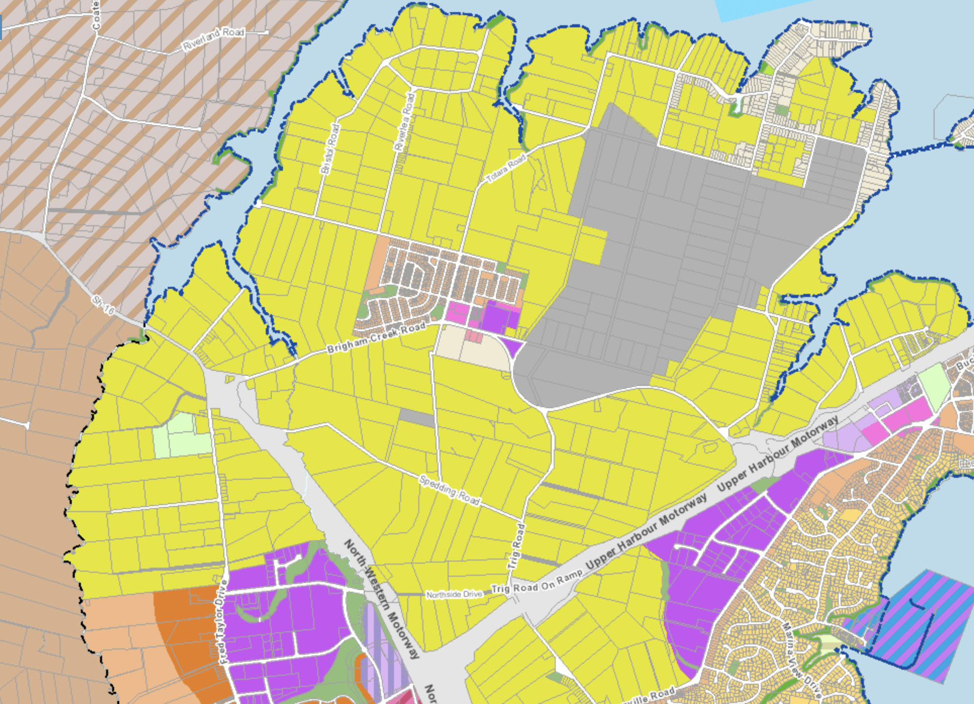
Land use and activities – the Structure Plan identifies low, medium and high density residential land development areas taking into account the airbase and other constraints, and following the Neighbourhood Design Statement.
Transport – higher residential densities
are located in proximity to Rapid Transit Network stations and park and ride facilities. Whenuapai will have a well-connected cycling and pedestrian network.
Infrastructure – significant upgrades to existing water supply and waste water networks are required as well as stormwater management is needed to manage these effects of growth. Development has to take into account the noise contours and flight paths of Whenuapai Airbase as well as the National Grid Corridor.
Natural environment and heritage –
retention of permanent and intermittent streams is crucial and will help determine where roads, open space and residential development will be located. Significant Ecological Areas and riparian margins are to be enhanced while existing archaeological and built heritage sites are to be protected.
Open space and recreation – esplanade reserves, a sports field, three suburban parks, a network of 14 neighbourhood parks and a civic space are to be provided in the structure plan area.